Constructed Territory
- December 14th, 2010
- Posted in Artwork . Shows
- By Carta (Dave and Paula)
- Write comment
With a background in cartography and geography, a juried exhibit at Wright State University caught our attention. The call for Constructed Territory (Oct 31, 2010 – Jan 9, 2011) promised to select “work integrating the use of maps, cartography, or environmental or topographical explorations.”
Curated by Assistant Professor of Art Tracy Longley-Cook, the exhibit features 32 artists working in photography, digital and mixed media, sculpture, drawing, printmaking and book arts. Constructed Territory “investigates geographical concepts from a range of perspectives to promote themes of exploration, navigation and the representation of physical space”.
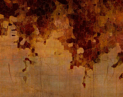
Dave has been working on a series of small (12 x 15 inches) prints that explores early land formation. The work is influenced by his research on early 16th century navigation methods and mapping from the 15th and 16th centuries. The first piece in this series, Terra Forming I, was selected for the exhibition.
The cartographer turned artist was a natural connection for this exhibit – and we’re pleased that Dave’s work was selected. As an secondary, but still interesting connection, Wright State University is hosting a musical concert in conjunction with Constructed Territory. Professor Christopher Dietz will be conducting his large ensemble performance Le Chemin de Salut (The Way of Salvation). “This musical concert reflects on the promise, difficulties, and ultimate tragedy that accompanied French colonization in the New World.” The performance will be on campus on January 11, 2011 in Dayton, OH.
For more information, see the Constructed Territory exhibit information.
Note: Quoted text in this blog is both from the exhibit information and exhibit prospectus.
